by Oswald Mederle
Both original Teiser plans (appeared in 2023) bear the signature of engineer Lieutenant Kardis of the former Brixen Genius Directorate.
The plan of the trenches at the Wetterkreuz is drawn in much more detail from December 1914, that of the trenches on the hood, probably from the spring of 1915.
As the weather cross is indicated as ‘base II’ and the hood as ‘base IV’, there must have been at least two other bases. Oswald Mederle sees the ‘base I’ on Heilig-Grab-Hügel and the ‘base III’ on the hill between the Wetterkreuz and the hood, now called Mesner Boden. There you can still find the remains of an extensive field fortification. Base IIIa ("Untere Scheaßler") is located halfway up on a rocky outcrop between Mesner Boden and Haube.
Plan of the facilities at Teiser Wetterkreuz-Hügel

Eichbichler family/Archiv Mederle, Bressanone
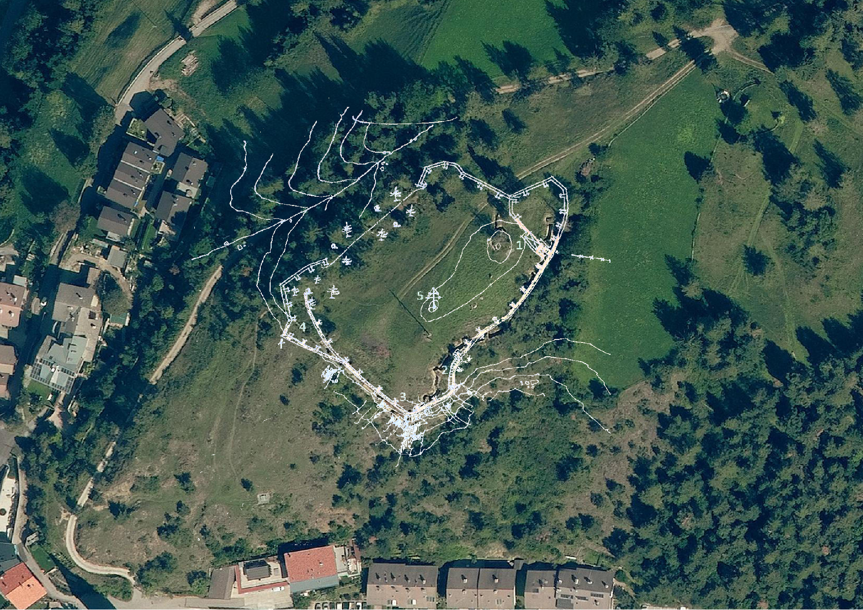
This currently only plan of the facility at the Wetterkreuz was signed by engineer Lieutenant Kardis and is dated 9. It was dated December 1914. It contains few details and can be seen as a kind of snapshot. On closer inspection, the accommodation for 20 men (1), the cast cement staircase (2), the machine gun stand (3) and the double ditch (4) in the west can already be made out in the rear part. The red-colored parts of the plant are under construction, those in white are only unplugged. The entire facility was securely covered against shrapnel fire.
From today's point of view, the kitchen (west of point 1) and the tunnel system located below point 1 in the north are missing. Also interesting is the drawing of the rows of barbed wire in the east.
The parts of the plant exposed today are almost identical to those marked in red.
It can also be seen that at that time all four ends of the transverse beams of the weather cross (5) were connected with wire to the cross tip.
Plan hood
This very precise and detailed plan, also signed by engineer Lieutenant Kardis, has remained without a date. It was most likely made between January and April 1915. All the installations marked in red in this plan are still preserved today, at least in part.

Eichbichler family/Archiv Mederle, Bressanone
The defensive structure on the hood is indicated as St. P. or base IV. The plan shows the aprons against the Villnöß valley (a and b) to the east, the trenches (1 to 5) built on small rocky peaks (‘Obere Scheaßler’) or carved in stone, the covered connecting trenches and the connecting paths between them.
On the left, towards the west, a part of bases III (on the ‘Mesner Boden’) and IIIa (‘Untere Scheaßler’) is marked.
To this day, on the hood masonry parts of the shelter (6) stand for 130 men. If you look closely, you can even see the drinking water reservoir (7) above it on the map, which has also been preserved to this day. In the north-east, access to a spring (8) is plotted at 200 steps = 150 m. The subsidence (9) indicated in the south of the facility, of which remnants of the wall are also preserved, is to be understood as cold and weather protection for the serving crew. Also interesting is the location of two latrines (10), today called toilets. As can be seen, they are located a bit away from the main residential complexes and close enough to the trenches so that the guards do not have to move too far from their position to meet their needs.
In the original legend (plan description), the trenches appear as strong-covered and the connecting trenches as rather light-covered. The Field Obstacles (11) consist of wooden poles rammed into the ground or L-iron rods walled in the rock, to which barbed wire is attached. The three- to four-row obstacles are all strongly wired to each other.
The last detail is the projected, 15% make out a steep track (12) for the supply of artillery (hooks) from the north.

 English (UK)
 Deutsch
 Italiano